

for North Carolina
Approved for North Carolina Classrooms!
See why Nystrom Young Citizens is a great fit for the North Carolina K-5 Social Studies Standard Course of Study
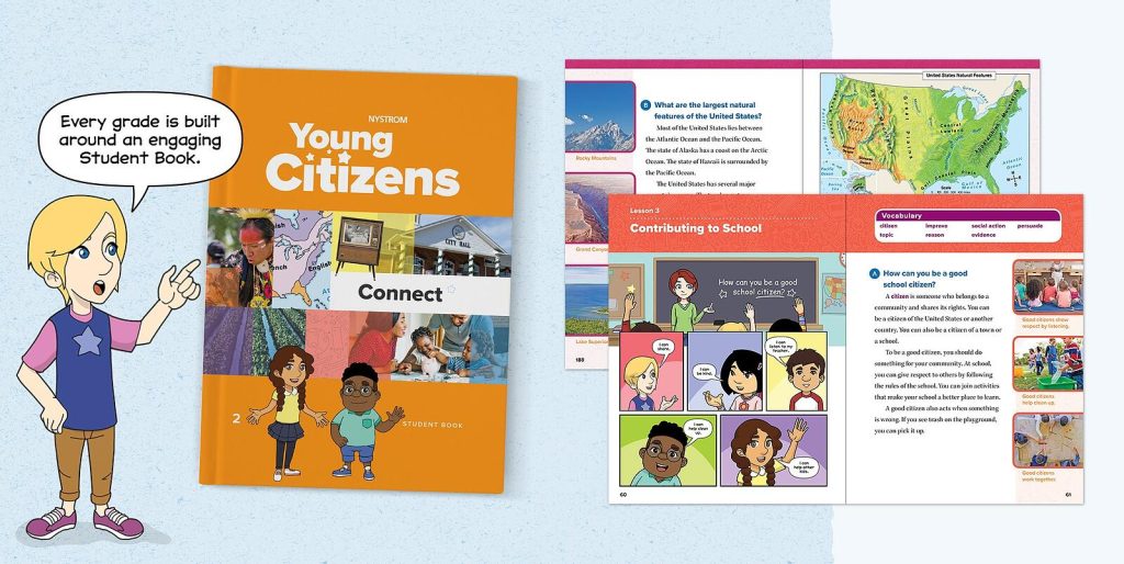
Student Book
The comprehensive Student Book features colorful graphic-novel-style narratives. Chapter readings explore communities, North Carolina, and our country. Historical photos and colorful graphics illustrate important content.
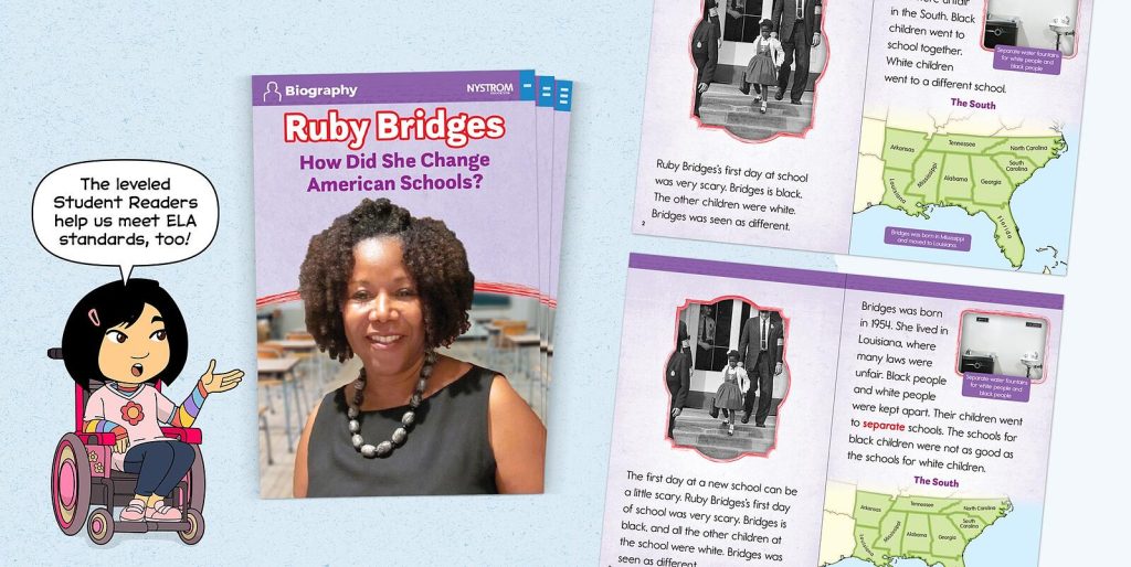
Leveled Student Readers
The Leveled Student Readers cover the same content at up to four reading levels. Each grade features its own collection, covering high-interest nonfiction topics. The Readers include pre- and post-reading activities and glossaries.
Group Activity Cards
Group Activity Cards foster collaboration, communication, and problem solving. Each card corresponds to a chapter in the Student Book. Engaging images give young students practice analyzing primary sources.
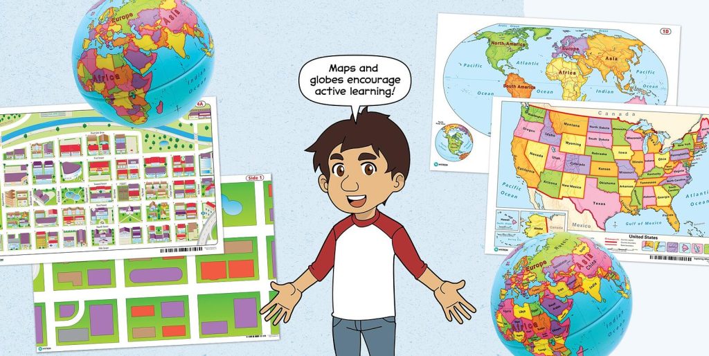
Maps & Globes
Markable maps and globes are designed for hands-on and collaborative learning. Students explore communities, North Carolina, our country, and the world. Each grade-level includes a variety of developmentally appropriate tools.
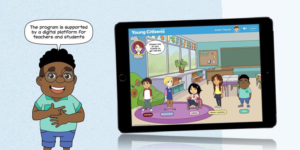
Digital Platform
The platform mirrors the print version of the program. It also includes interactive activities and assessments to give students extra practice and built-in tools for teachers, such as auto-scoring and student-tracking tools.
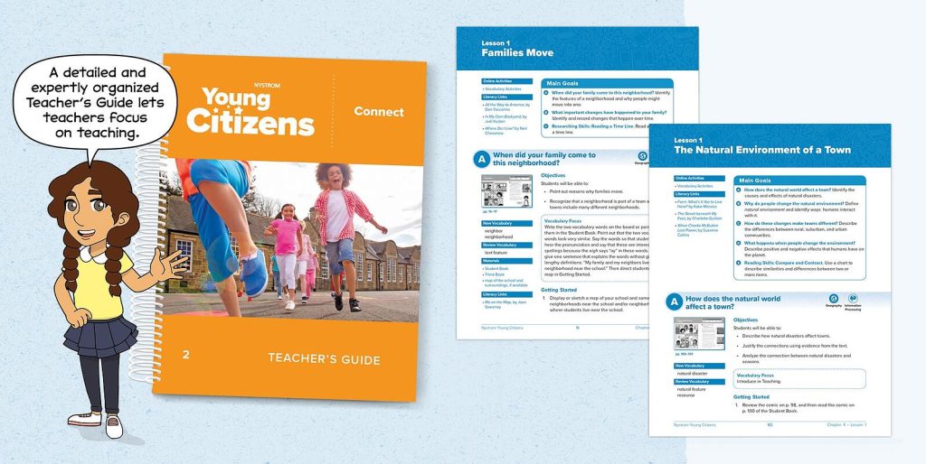
Teacher’s Guide
The detailed Teacher’s Guide provides pre-assessment ideas, chapter-pacing suggestions, and classroom assessment activities. Each lesson includes learning objectives and modifications for above-level, below-level, and ELL students.
Explore grade levels!
Hi, I’m Minar!
My four friends and I each have diverse stories to tell — which are all woven into Nystrom Young Citizens! We help relate students to the lessons they learn, and build standard skills at every grade level!

A skill-building curriculum...
Promotes Inquiry
The hands-on nature of the curriculum fosters student-led inquiry, which helps develop key social studies skills and 21st-century skills such as critical thinking.
Promotes Literacy
The curriculum integrates social studies and ELA to help students build complex literacy skills using components such as the Leveled Student Readers.
Promotes Depth of Knowledge
Each lesson is designed to enhance student depth of knowledge through recall, skills and concepts, strategic thinking, and extended thinking.
…focused on social studies
Empowers Differentiation
The curriculum’s library of Leveled Student Readers enables teachers to differentiate learning. In addition, lesson plans suggest modifications for above-level, below-level, and ELL students.
Hands-On Learning
The curriculum fosters genuine hands-on learning using a variety of desk maps and globes. Kid-sized by design, these markable tools promote geographic literacy and geographic thinking.
Technology Based
A robust interactive online learning platform provides teachers with flexibility and time-saving tools. And it gives students opportunities for extra practice while building 21st century skills.

YOUNG CITIZENS
Kindergarten
The Kindergarten curriculum sets the foundation for students to learn key social studies themes. The Student Book explores themes of rules, responsibility, and citizenship, while the hands-on maps and globes help students understand community and geography.
Program components:
- 1 Teacher’s Guide
- 1 Student Handouts
- 30 Student Books
- 30 Markable Community Desk Maps
- 30 Markable U.S. and World Desk Maps
- 6 Markable Hands-on 9" Activity Globes
- 10 Leveled Student Readers at 2 Different Levels
- Group Activity Cards
- Markable Neighborhood Floor Map
- Wet-erase Markers
- Digital Subscription

YOUNG CITIZENS
Grade 1
The Grade 1 curriculum continues to scaffold key social studies themes. The Student Book sets the foundation for historical knowledge and each chapter guides learning with an essential question. The group activity cards give students the opportunity to begin building primary source analysis skills.
Program components:
- 1 Teacher’s Guide
- 1 Student Handouts
- 30 Student Books
- 30 Markable Community Maps
- 30 Markable U.S. and World Desk Maps
- 6 Markable Hands-on 9" Activity Globes
- 7 Leveled Student Readers at 4 Different Levels
- Group Activity Cards
- Wet-erase Markers
- Digital Subscription
YOUNG CITIZENS
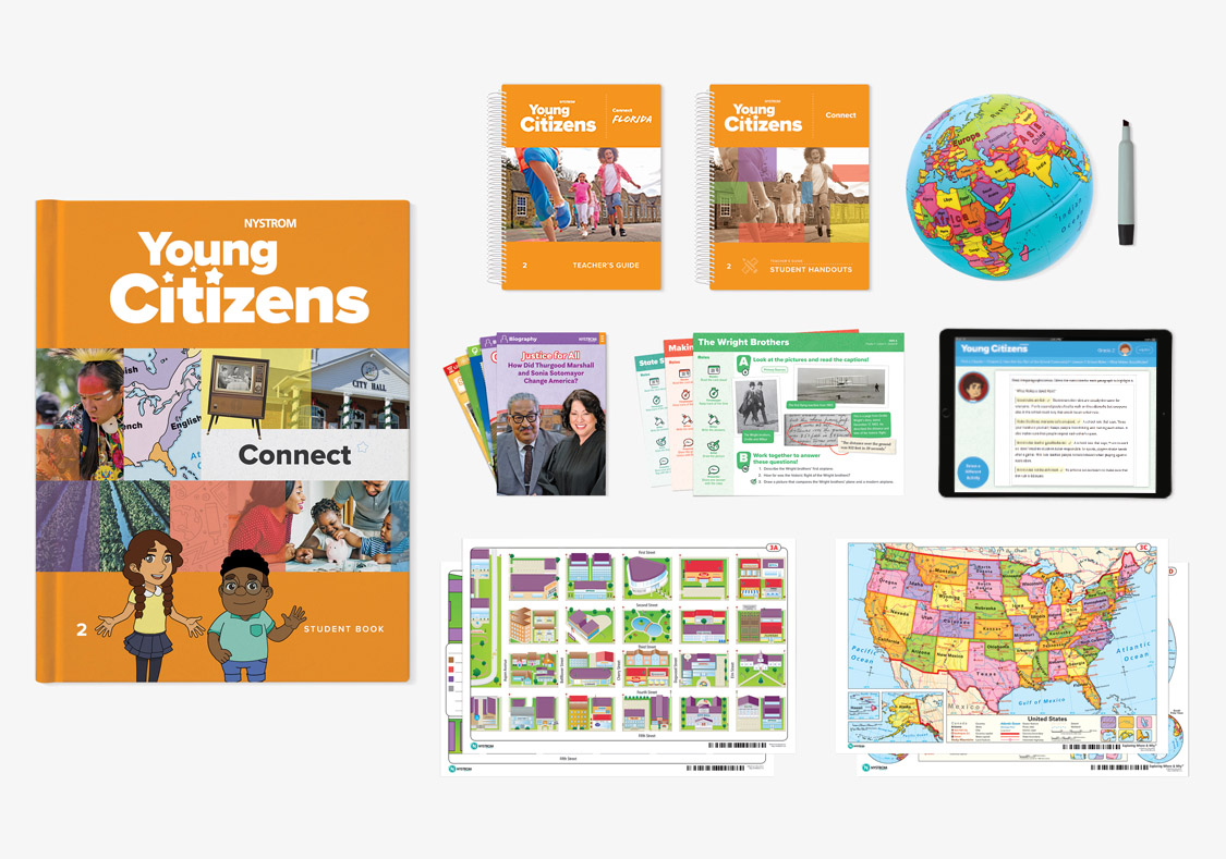
Grade 2
The Grade 2 curriculum continues to scaffold the foundation for social studies set in earlier grades. The materials expand student knowledge of United States policies, government, and economics. The markable globes and desk maps help students understand the physical and human characteristics of their environment.
Program components:
- 1 Teacher’s Guide
- 1 Student Handouts
- 30 Student Books
- 30 Markable Community Maps
- 30 Markable U.S. and World Desk Maps
- 6 Markable 3-D Raised Relief Maps
- 6 Markable Hands-on 9" Activity Globes
- 7 Leveled Student Readers at 4 Different Levels
- Group Activity Cards
- Wet-erase Markers
- Digital Subscription
YOUNG CITIZENS
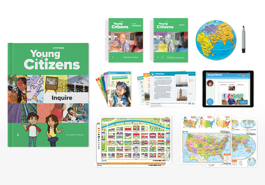
Grade 3
The Grade 3 curriculum dives deeper into themes of government, geography, and culture and builds on previously established student skills. The program components guide students to compare and contrast key themes and expand student knowledge about the world around them.
Program components:
- 1 Teacher’s Guide
- 1 Student Handouts
- 30 Student Books
- 30 Markable Community Maps
- 30 Markable U.S. and World Desk Maps
- 6 Markable 3-D Raised Relief Maps
- 6 Markable Hands-on 9" Activity Globes
- 7 Leveled Student Readers at 4 Different Levels
- Group Activity Cards
- Wet-erase Markers
- Digital Subscription

YOUNG CITIZENS
Grade 4
The Grade 4 curriculum teaches students about North Carolina's history. These materials expand student knowledge of their own community policies, government, economics, and unique history. The markable globes and desk maps help students build key mapping skills and learn about North Carolina and the larger world around them.
Program components:
- 1 Teacher’s Guide
- 1 Student Handouts
- 30 Student Books
- 30 Markable U.S. & World Desk Maps
- 30 Markable State Desk Maps
- Group Activity Cards
- 160 Leveled Student Readers (5 titles, 4 levels)
- 6 Markable Hands-on 9" Activity Globes
- Wet-erase Markers
- Digital Platform Access
YOUNG CITIZENS
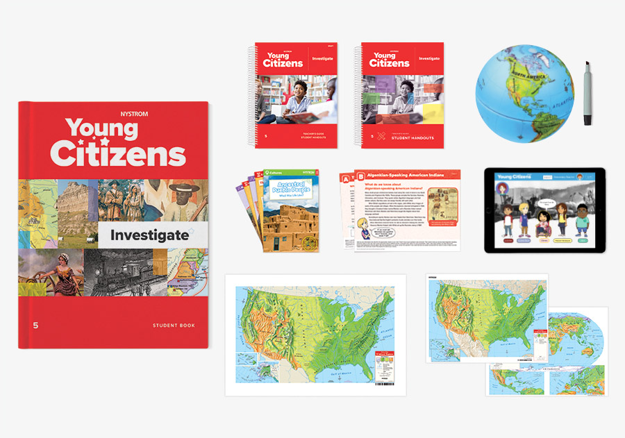
Grade 5
The Grade 5 curriculum gives students tools to investigate themes, events, ideas, and people in United States history. The program components foster advanced learning by deepening student understanding and highlighting how the founding, forming, and transforming of America has been shaped by diverse elements.
Program components:
- 1 Teacher’s Guide
- 1 Student Handouts
- 30 Student Books
- 30 Markable U.S. & World Desk Maps
- 15 Raised Relief Maps
- Group Activity Cards
- 240 Leveled Student Readers (6 titles, 4 levels)
- 6 Markable Hands-on 9" Activity Globes
- Wet-erase Markers
- Digital Platform Access
Get in touch to learn more and request a free sample!


Curriculum Specialist

Madison Westphal
(800) 421-4246 x278
