My Account / Cart / Log In

Texas Specific
Resources

Designed to inspire deep interaction with content while aligning with standards in your state. 

Embrace Texas Heritage

All the Texas resources specifically designed to fit all of your classroom needs

NYS3162_Texas_cvr

Texas Studies, Grades 4 and 5

Available in print and digitally


A variety of readings and correlated activities that turn students into Lone Star scholars. Texas Studies includes a student reader and teacher’s guide with reproducible handouts (available in Spanish). You and your students can also access Texas Studies Level I digitally on Active Classroom.
nw_ipad_1

Digitized Elementary Map Sets

Featured on Nystrom World

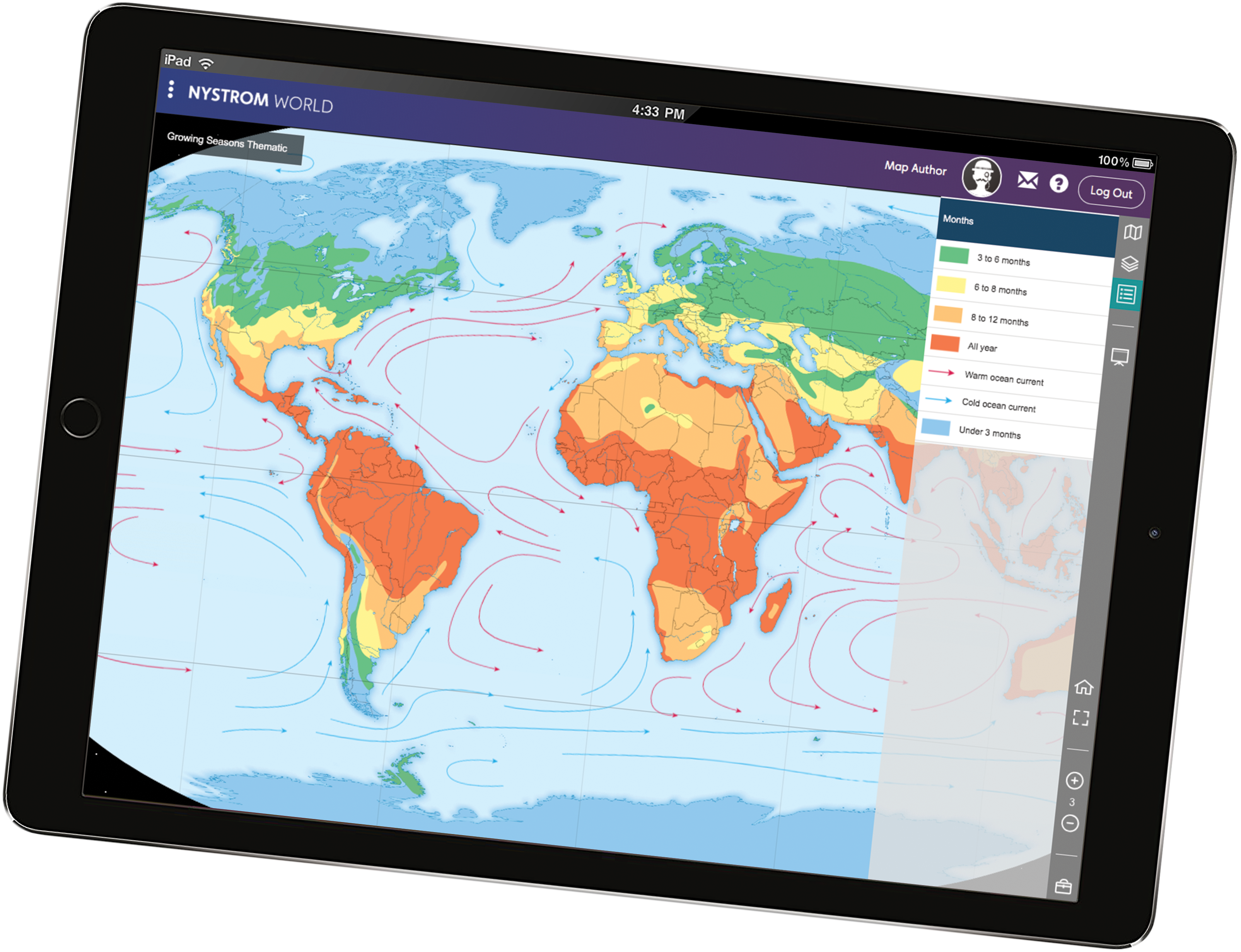
Digital versions of the Nystrom elementary maps you’ve come to rely on. A useful toolbar makes it easy for students to navigate the maps, zoom in, and mark them up, which improves accessibility and leads to deeper knowledge.
ac_collage

Texas State Edition Active Classroom License

A core curriculum plus supplemental resources

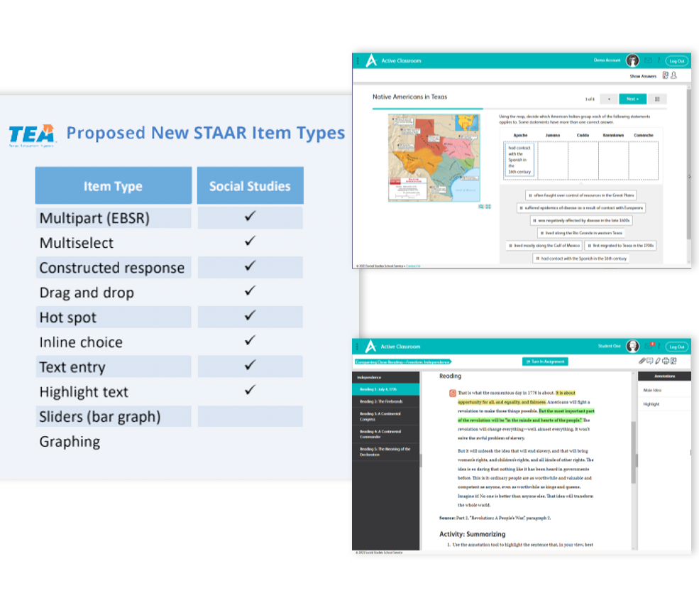
A variety of social studies courses, inquiry-based activities, and other digital resources aligned to Texas state standards. Active Classroom, an easy-to-use platform, also provides assessments with question types that are STAAR approved for the Texas classroom.
AAMAIPAD

Mexican American and African American Studies

Included in the Texas State Edition Active Classroom License

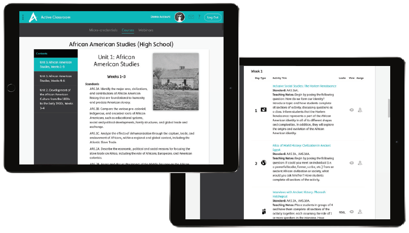
Innovative courses with skill-building activities. Our new Mexican American Studies course with curriculum maps is now available in Active Classroom. The African American Studies course with curriculum maps is coming soon in fall 2021.
Texas_Atlas_Pack_image

Atlas of Texas History and Student Activities

New from Nystrom, available in print and digitally

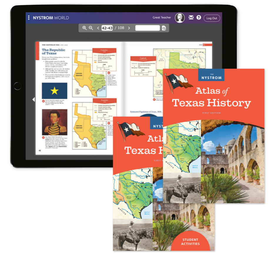
Specifically designed to meet the revised TEKS. The Atlas of Texas History and correlated activities engage students with compelling maps, graphics, and photographs as well as a diversity of notable historical figures. Access the e-atlas and exclusive interactive activities on Nystrom World.
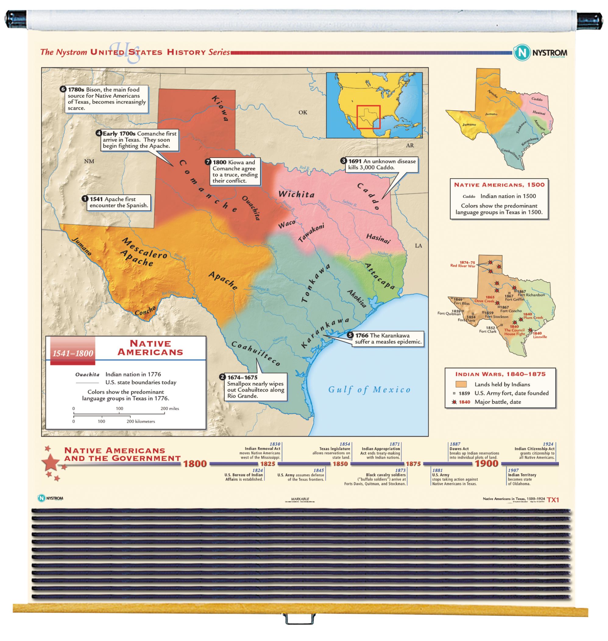
Texas_History

Texas/U.S./World Map Set

Physical wall maps

Colorful, easy-to-use, well-organized wall maps. Give students a visual understanding of Texas county boundaries, geographical features, capitals, and city populations. The wall maps are mounted on a spring roller for quick access.
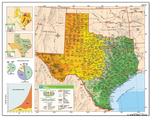
Texas_DeskMap

Desk Maps

Student-sized versions of the Texas wall maps

Markable desk maps make it easy for students to follow along as the teacher highlights features on the wall maps. The desk maps facilitate hands-on mapping activities that cement the learning of geographical features, capitals, city populations, and more.
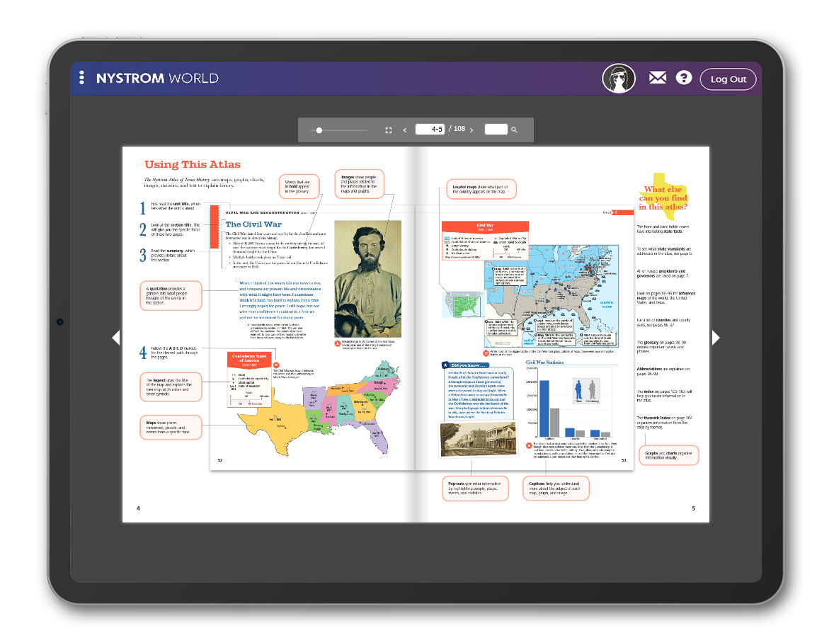
AOTXH_ipad

Texas on Nystrom World

A variety of digital resources for blended classrooms

Support learning anytime, anywhere. Access the Atlas of Texas History, in English and Spanish, Texas Interactive Mapping Activities, and other engaging resources as well as teaching and learning tools—all from one easy-to-use dashboard.
DecisionMakingTexas

TEXAS: Decision Making in U.S. History

Reproducible activity book

Also available as a download. Involve students in real historical problems that convey powerful lessons about Texas history with these thought-provoking activities. Students will build on their decision-making, critical-thinking, and perspective-taking skills.
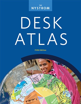
NYS1351_DeskAtlas

Nystrom Desk Atlas

Official atlas for the University Interscholastic League (UIL) A+ contest

Features up-to-date maps, graphs, photos, infographics, and articles. Empower all types of learners to explore important environmental, humanitarian, economic, and cultural issues affecting the world today. Available in print and as an e-book with interactive activities on Nystrom World.

New in this Edition

All maps, charts, graphs, captions, and Issues Today articles in the newest Nystrom Desk Atlas have been
updated to reflect the most recent data. This longer edition also includes a new design and new photos.

New Content:

  • New Understanding Map Projections spread
  • New chart, graph, and information about internally displaced people
  • New map covering the Syrian refugee crisis
  • New map of Cuba and its neighbors
  • New Deforestation map
  • New Air Pollution map
  • New Issues Today articles: National Development, Refugees, International Organizations, Urbanization, and Rising Sea Level
  • And more!
Image of a quotation mark
“The Atlases are age appropriate and are bright and inviting for the students. The teachers like the resources that go with the atlases since they connect with literacy lessons and standards. I also like how the atlases build upon each other each year, you can really see the progression of geography skills.”
Suzanne Gons
District Supervisor of Social Studies

Register for a free trial.

Please fill out the form and a Nystrom representative will be in touch shortly.

Elementary

  • Maps: Primary: ELS
  • Maps: Primary: Readiness
  • Maps: Primary: Outline World Map
  • Maps: Intermediate: Physical
  • Maps: Intermediate: Political
  • Maps: Intermediate: Continents and Oceans Thematic
  • Maps: Intermediate: Wealth of Countries Thematic
  • Maps: Intermediate: Precipitation Thematic
  • Maps: Intermediate: Temperature Thematic
  • Maps: Intermediate: Time Zones Thematic
  • Maps: Intermediate: Land Use Thematic
  • Maps: Intermediate: Population Thematic
  • Maps: Intermediate: Outline World Map
  • U.S. History:1 Native Americans
  • U.S. History:2 Spanish Explorers
  • U.S. History:3 Explorers
  • U.S. History:4 The Great Exchange
  • U.S. History:5 European Settlements
  • U.S. History:6 Thirteen Britishi Colonies
  • U.S. History:7 Slevery In the Americas
  • U.S. History:8 Revolutionary War
  • State Map

Secondary

  • Maps: Intermediate: Physical
  • Maps: Intermediate: Political
  • Maps: Intermediate: Continents and Oceans Thematic
  • Maps: Intermediate: Wealth of Countries Thematic
  • Maps: Intermediate: Precipitation Thematic
  • Maps: Intermediate: Temperature Thematic
  • Maps: Intermediate: Time Zones Thematic
  • Maps: Intermediate: Land Use Thematic
  • Maps: Intermediate: Population Thematic
  • Maps: Intermediate: Outline World Map
  • Maps: Secondary: Land Use Thematic
  • Maps: Secondary: Population Thematic
  • Maps: Secondary: Political Relief
  • Maps: Secondary: Land Cover
  • Maps: Secondary: Scupltural Relief
  • Maps: Secondary: Growing Seasons Thematic
  • Maps: Secondary: Climate Thematic
  • Maps: Secondary: Tectonic Plates Thematic
  • Maps: Secondary: Precipitation Thematic
  • Maps: Secondary: Outline World Map
  • State Map

U.S. History

  • Native Americans
  • Spanish Explorers
  • Explorers
  • The Great Exchange
  • European Settlements
  • Thirteen British Colonies
  • Slavery in the Americas
  • Revolutionary War
  • American Expansion
  • Explorations of the West
  • Trails West
  • War with Mexico
  • Slavery Divides the Nation
  • Slavery and the Economy
  • Union and Confederacy
  • Civil War
  • Conflicts with Indians
  • Railroads Tansform the West
  • Industrial United States
  • Immigrants 1895–1929
  • World War I in Europe
  • Great Depression and Dust Bowl
  • World War II in Europe 1939–1942
  • World War II in the Pacific 1941–1945
  • Great Migration 1940–1970
  • Korean War
  • Cold War
  • Vietnam War
  • Persian Gulf War
  • A Shifting Population
  • Immigrants Sinve 1970

World History

  • New Babylonian Empire
  • Ancient Egypt
  • Chinese Dynasties
  • Ancient India
  • Athens and Sparta
  • Alexander’s Empire
  • Roman Empire
  • Barbarians and the Roman Empire
  • Silk Road and Eurasian Trade
  • Byzantine Empire
  • Charlemagne’s Frankish Empire and the Holy Roman Empire
  • Spread of Islam
  • World of the Crusades
  • China in the Middle Ages
  • Mongol Conquest
  • Rise and Fall of Shogun Japan
  • Exploration
  • Maya, Aztec, and Inca
  • European Exploration and Land Claims
  • African Empires and States
  • Rise of Ottoman Empire
  • Reformation and Counter Reformation
  • European Trading Empires
  • Rise and Fall of Mughal Empires
  • Independence in the Americas
  • Napoleon’s Europe
  • Europe After the Congress of Vienna
  • Africa Under Foreign Rule
  • World War I
  • World War II
  • Cold War
  • World Conflicts Since 1991

Texas

  • Spanish Explorers
  • Western Explorations
  • Trails West
  • War with Mexico
  • Indian Wars
  • Railroads & The West
  • Great Migration
  • population Loss and Growth
  • Native Americans in TX
  • Spanish Settlements
  • Republic of Texas
  • Energy Resources of TX
  • Texas Readiness Map
  • Texas Desk Map
  • Texas State Map