Social Studies Success for All
Ensure that all of your students across the district build the skills they need to master social studies! Let’s work together to customize a set of supplemental
resources that meet your district’s goals and standards.
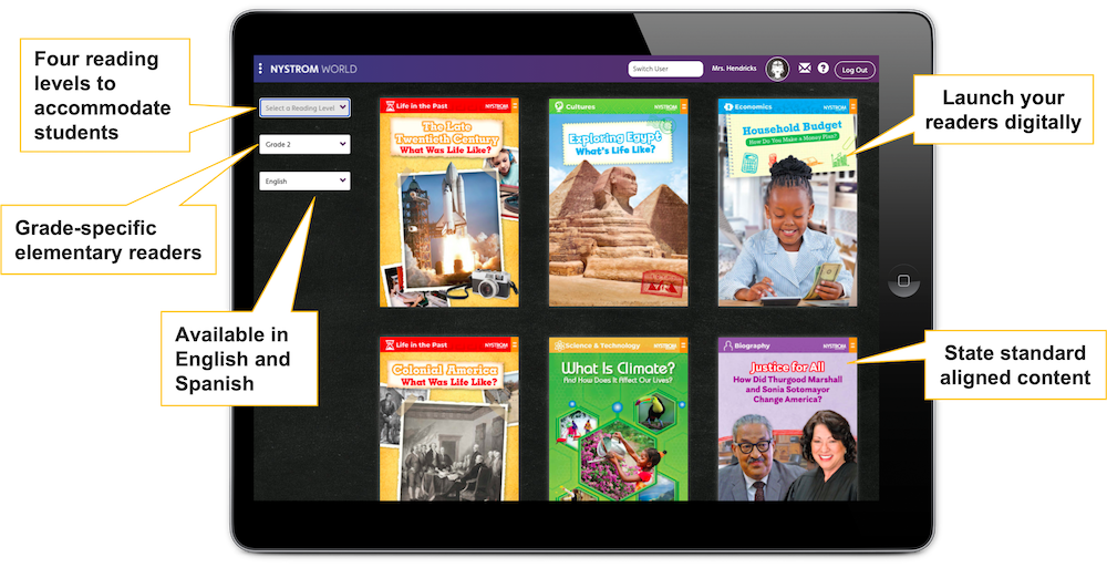
Primary Sources for Primary Schools
Introduce young learners to
historical images, illustrations, and
documents with a library of leveled
Social Studies Readers. Our K-5 readers
cover the same content at four levels,
helping students analyze primary and
secondary sources with the support of
leveled text.
Available in print and online at Nystrom World
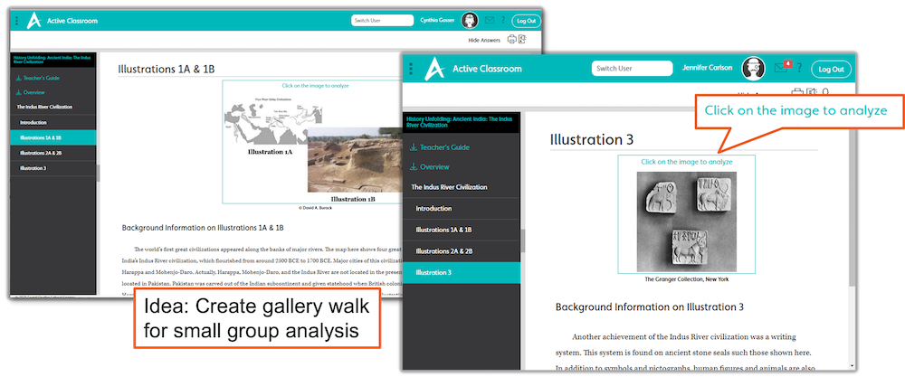
Primary Sources for Secondary Schools
Give 6-12 students access to
hundreds of primary and secondary
sources with Active Classroom. This
digital learning platform includes
built-in image analysis tools that
support students in analyzing primary
sources, from artifacts to political
cartoons.
Learning platform with built-in tools
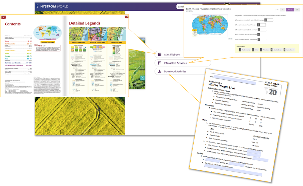
Data-Rich Sources for K-12
Give students digital access to
all of our atlases, which feature a
variety of images, graphs, and charts.
The Researcher, accessed through Nystrom
World, is home to atlases and
interactive activities that guide
students in analyzing secondary sources.
Explore Nystrom World Researcher
E-book atlases and interactive activities

Activities for K-5
K-5 Social Studies Readers cover
the same content at four reading levels.
Every reader includes pre- and
post-reading activities to support
reading comprehension, including writing
prompts that guide students in
responding to the text.
Available in print and online at Nystrom World
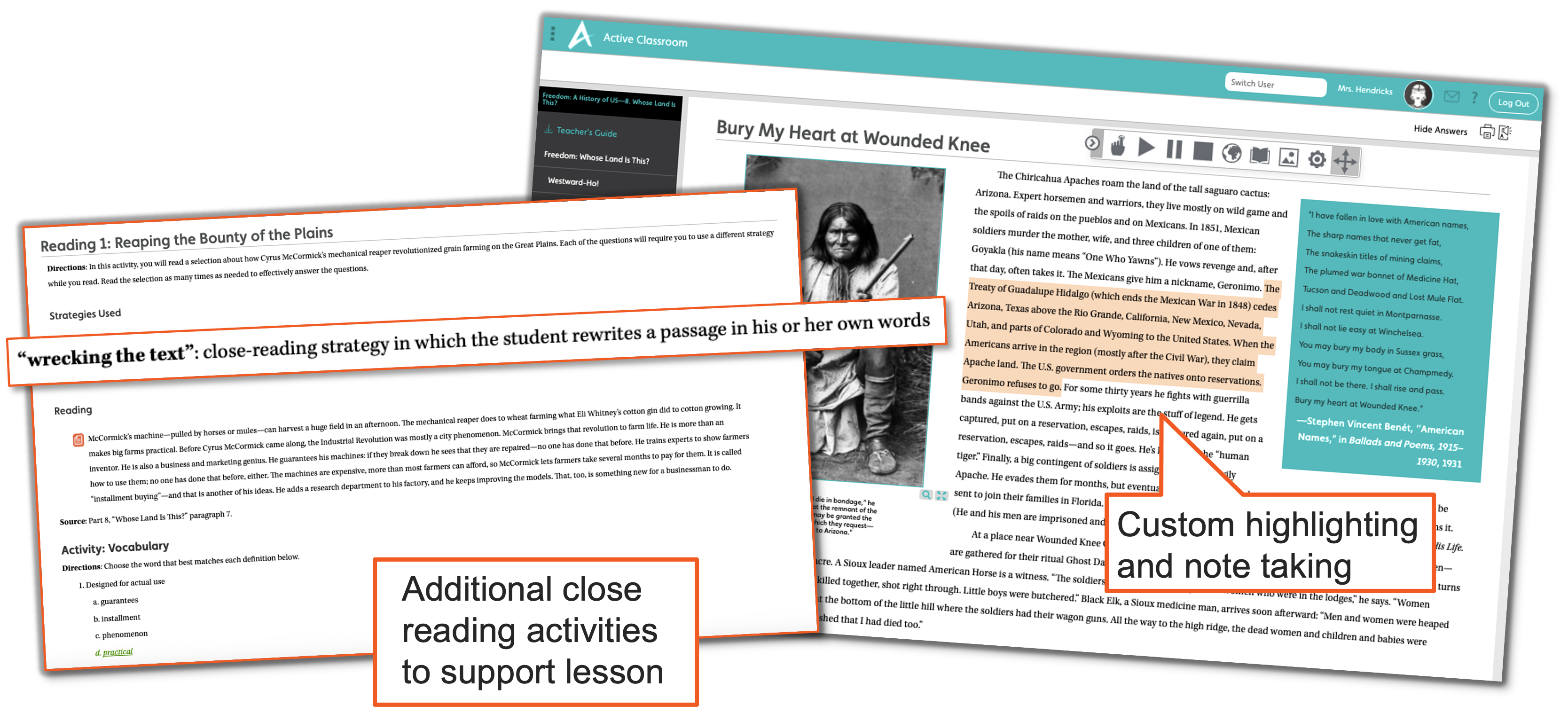
Prompts for 6-12
Secondary students build literacy
skills through the close readings,
writing prompts, and research projects
included in Active Classroom. Their work
is supported by translation,
text-to-speech, and annotation tools as
well as graphic organizers.
Learning platform with built-in tools
Content Area for K-12
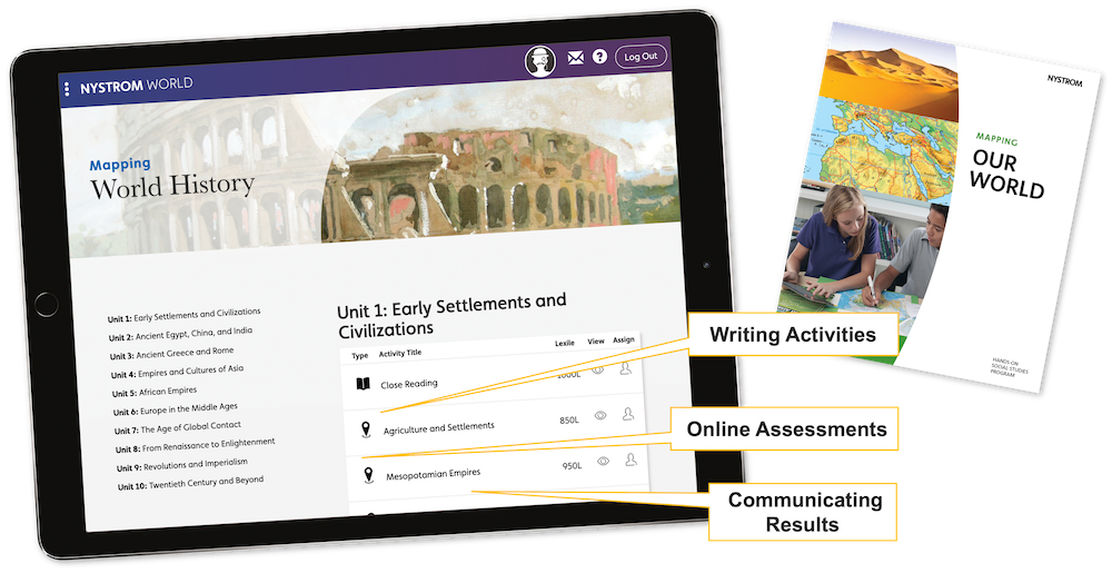
Our mapping programs foster two
kinds of literacy: "text" literacy and
geographic literacy. Students read and
write in the content area of geography.
Elementary students are guided by
Encompass, our new hands-on
mapping program. Secondary students
explore the geographic history of the
United States and the world.
Available in print, digital coming in 2023
Explore Secondary Mapping Programs
Available in print and online at Nystrom World
Elementary Atlases
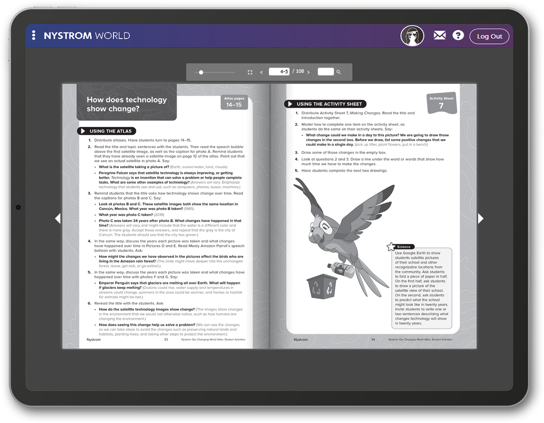
Our elementary atlases and
activities give young students practice
in making inferences and drawing
conclusions. Students are guided by
chunked text, images, maps, and data in
making connections between the peoples
and places that make up the world around
them.
Available in print and online at Nystrom World
Secondary Texts
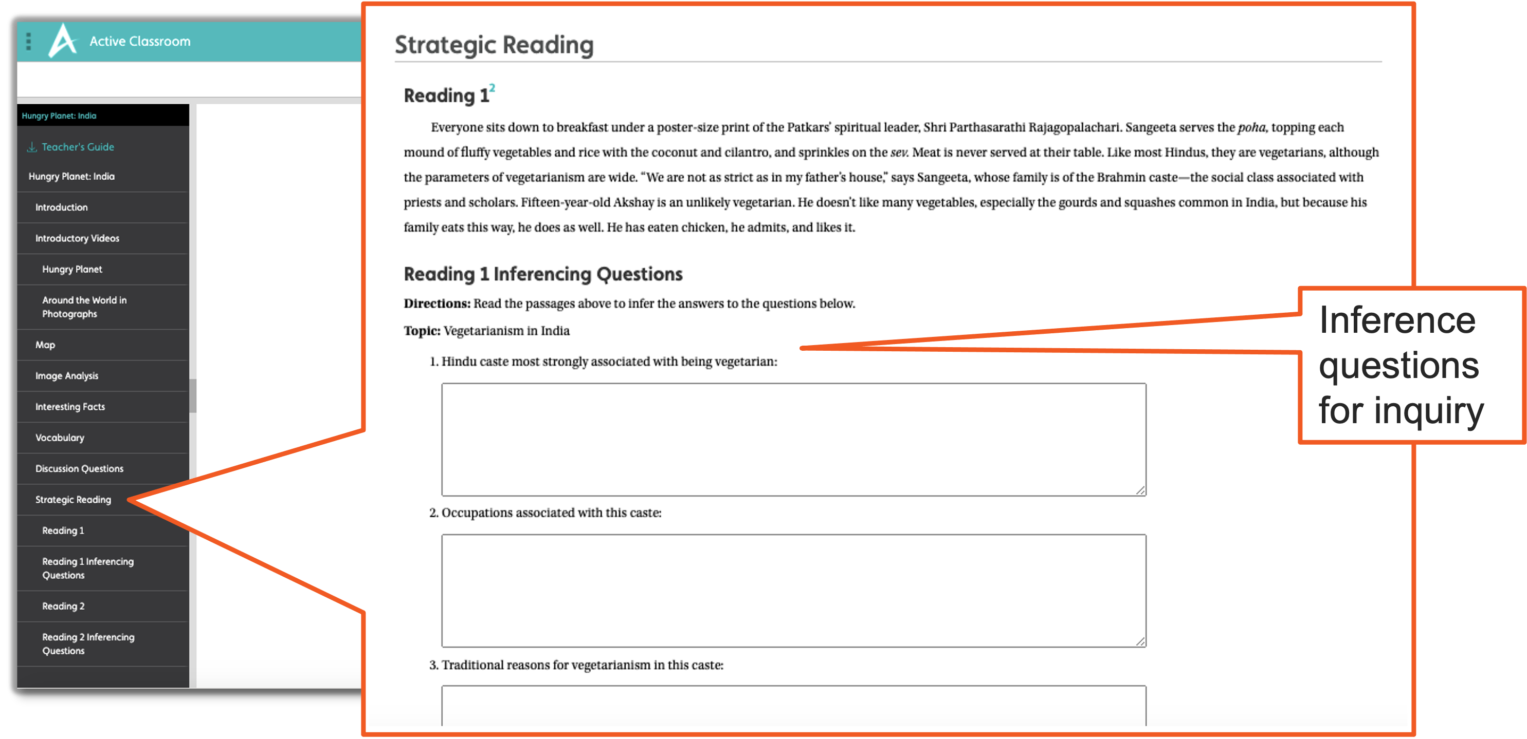
Active Classroom is home to a
number of texts that guide secondary
students in making inferences and
drawing conclusions.
History's Mysteries and Peter
Menzel's Hungry Planet are two
examples of texts that engage students
while teaching essential skills.
Learning platform with built-in tools
Simulations for Grades 4-12
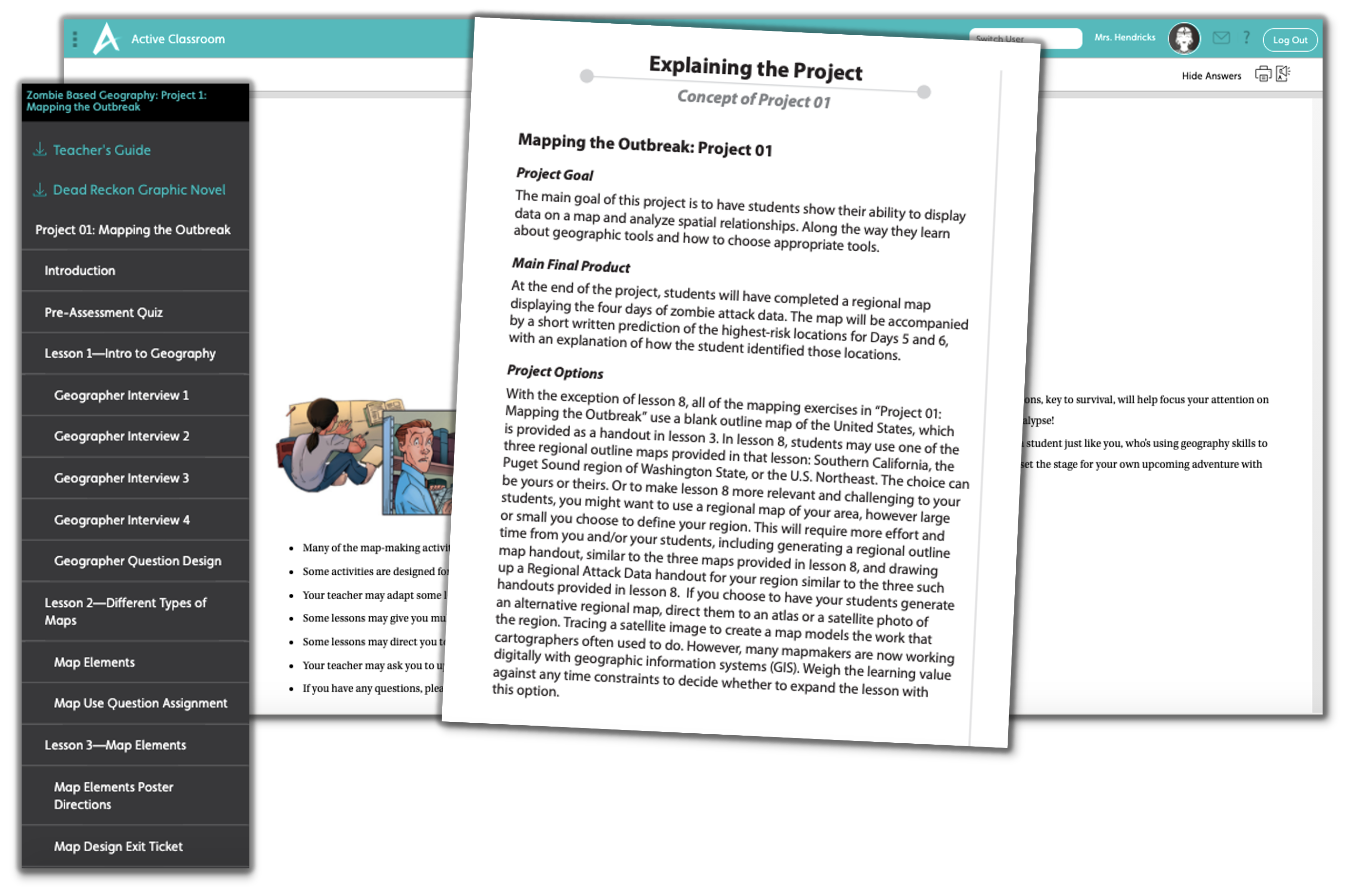
Simulation-based learning is a
highly engaging way to teach essential
skills. Students make inferences and
draw conclusions during a collaborative
quest in Caravans and while
trying to survive a zombie apocalypse in
Zombie-Based Geography.
Available in print and online at Active Classroom
Key Events in History
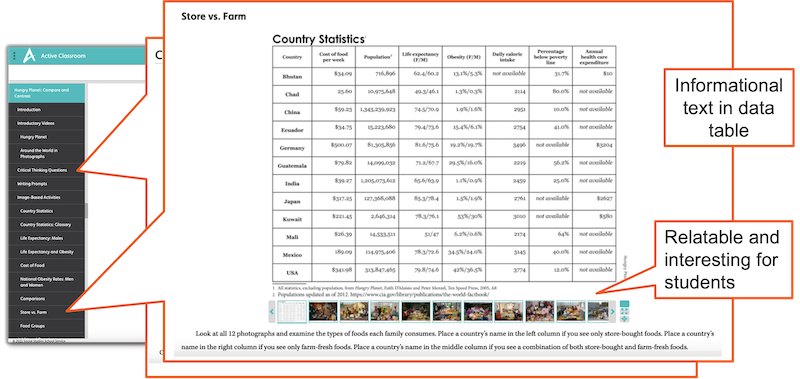
Active Classroom includes
courses and texts that help secondary
students understand the causes and
effects of history up to modern times.
Students collect evidence from close
readings, informational text, and
primary and secondary sources,
including audio clips, documents,
photographs, and videos.
Learning platform with built-in tools
Historical Issues Today
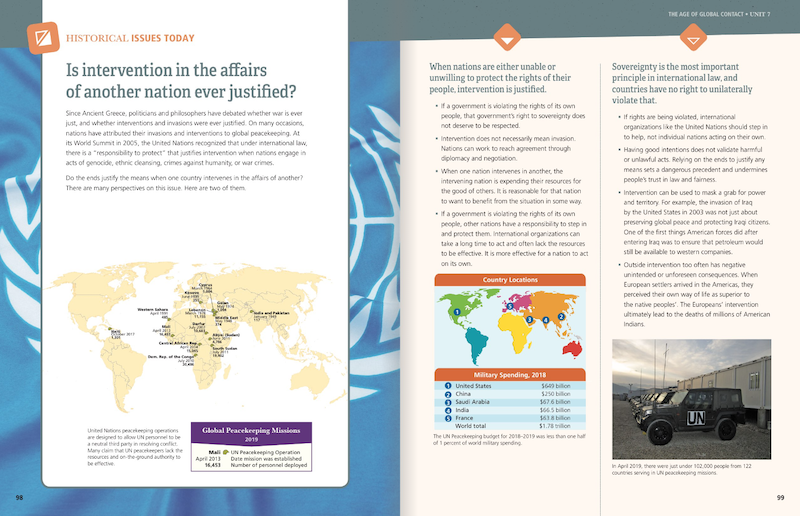
Using multistep problems in
Mapping World History and
Mapping United States History
and "Historical Issues Today" articles
in the Atlas of World History,
secondary students examine the causes
and effects of history. The articles
provide two points of view on a
current issue viewed through the lens
of history.
Available in print and online at Nystrom World
Hands-On for K-12
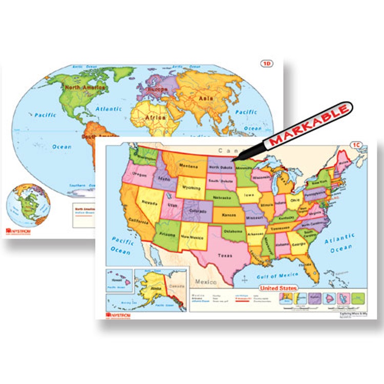
Teach map interpretation skills
using a variety of maps and globes and
you'll also increase reading, math,
visual literacy, and spatial thinking
too. Because all of these skills are
involved when students interpret maps.
Our maps and globes are scaffolded for
students from kindergarten through
secondary school.
Explore Nystrom Maps and Globes
Markable maps and globes

Interactive for K-12
Get students' hands on
interactive maps and globes too,
through Nystrom World's Geographer.
Your students will have access to 3D
globes as well as outline, satellite,
political, and thematic maps, which
they'll mark up using a built-in
Toolbox.
Digital maps and globes
Get in Touch
Please fill out the form and we’ll be in touch shortly.
