Author Spotlight

Peter Menzel

Enrich the learning experience by bringing culture and food from around the globe to your classrooms

Travel the World with Peter Menzel

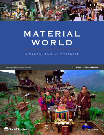
Peter Menzel is a photographer known for his coverage of international feature stories on science and the environment. He has published five books including Material World: A Global Family Portrait (1994) and Hungry Planet: What The World Eats (2005).

Teaching Diversity Through Food

Learn about families from various cultures and the diversity of food and nutrients. These intimate family portraits illustrate the importance of food and sustainability from different cultural perspectives.

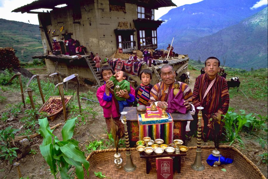
New Perspectives on Culture

Explore the Teaching of geography and economics through the diversity of food and material belongings from across the globe.

The Power of Food and Materials

Get students excited about discovering how other families  live and read all about their unique cultural recipes.
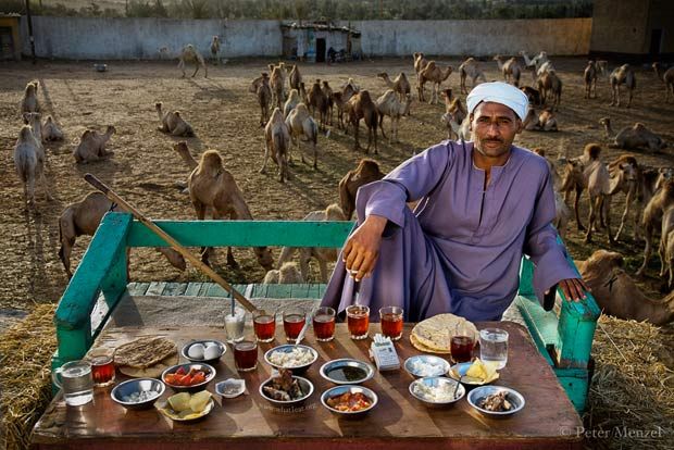
Image of a quotation mark
“Peter explores both the cultural differences of diets around the world as well investigating how prosperity and poverty influence the diets of different nations.”
Thomas Ingersoll
Photographer

Use these products in unison with our atlases to conceptualize geography
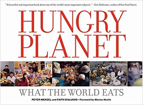
51QQB3R6G6L._SY367_BO1_204_203_200_

Discover How People Around the World Eat

Hungry Planet showcases 30 families from different parts of the world and describes what they consume and spend on a weekly basis

Get updated statistics and historical facts about each country:

  • Each family featured is considered statistically average for their nation
  • Learn how calories and nutritional values change based on economic and geographic needs
  • Perfect resource for students studying geography and culture
    View Product

ZP945_MatWorGui_CV_v3.5


Uncover More

The Importance of Materials

Create a visual understanding on what the average family life looks like globally

Uncover cultural differences worldwide:

  • Get to know families on a personal level
  • Find what possessions are valued in different countries
  • Help students grasp how lifestyles vary based on culture and location
    View Products


Enhance the Classroom

Contact us

Elementary

  • Maps: Primary: ELS
  • Maps: Primary: Readiness
  • Maps: Primary: Outline World Map
  • Maps: Intermediate: Physical
  • Maps: Intermediate: Political
  • Maps: Intermediate: Continents and Oceans Thematic
  • Maps: Intermediate: Wealth of Countries Thematic
  • Maps: Intermediate: Precipitation Thematic
  • Maps: Intermediate: Temperature Thematic
  • Maps: Intermediate: Time Zones Thematic
  • Maps: Intermediate: Land Use Thematic
  • Maps: Intermediate: Population Thematic
  • Maps: Intermediate: Outline World Map
  • U.S. History:1 Native Americans
  • U.S. History:2 Spanish Explorers
  • U.S. History:3 Explorers
  • U.S. History:4 The Great Exchange
  • U.S. History:5 European Settlements
  • U.S. History:6 Thirteen Britishi Colonies
  • U.S. History:7 Slevery In the Americas
  • U.S. History:8 Revolutionary War
  • State Map

Secondary

  • Maps: Intermediate: Physical
  • Maps: Intermediate: Political
  • Maps: Intermediate: Continents and Oceans Thematic
  • Maps: Intermediate: Wealth of Countries Thematic
  • Maps: Intermediate: Precipitation Thematic
  • Maps: Intermediate: Temperature Thematic
  • Maps: Intermediate: Time Zones Thematic
  • Maps: Intermediate: Land Use Thematic
  • Maps: Intermediate: Population Thematic
  • Maps: Intermediate: Outline World Map
  • Maps: Secondary: Land Use Thematic
  • Maps: Secondary: Population Thematic
  • Maps: Secondary: Political Relief
  • Maps: Secondary: Land Cover
  • Maps: Secondary: Scupltural Relief
  • Maps: Secondary: Growing Seasons Thematic
  • Maps: Secondary: Climate Thematic
  • Maps: Secondary: Tectonic Plates Thematic
  • Maps: Secondary: Precipitation Thematic
  • Maps: Secondary: Outline World Map
  • State Map

U.S. History

  • Native Americans
  • Spanish Explorers
  • Explorers
  • The Great Exchange
  • European Settlements
  • Thirteen British Colonies
  • Slavery in the Americas
  • Revolutionary War
  • American Expansion
  • Explorations of the West
  • Trails West
  • War with Mexico
  • Slavery Divides the Nation
  • Slavery and the Economy
  • Union and Confederacy
  • Civil War
  • Conflicts with Indians
  • Railroads Tansform the West
  • Industrial United States
  • Immigrants 1895–1929
  • World War I in Europe
  • Great Depression and Dust Bowl
  • World War II in Europe 1939–1942
  • World War II in the Pacific 1941–1945
  • Great Migration 1940–1970
  • Korean War
  • Cold War
  • Vietnam War
  • Persian Gulf War
  • A Shifting Population
  • Immigrants Sinve 1970

World History

  • New Babylonian Empire
  • Ancient Egypt
  • Chinese Dynasties
  • Ancient India
  • Athens and Sparta
  • Alexander’s Empire
  • Roman Empire
  • Barbarians and the Roman Empire
  • Silk Road and Eurasian Trade
  • Byzantine Empire
  • Charlemagne’s Frankish Empire and the Holy Roman Empire
  • Spread of Islam
  • World of the Crusades
  • China in the Middle Ages
  • Mongol Conquest
  • Rise and Fall of Shogun Japan
  • Exploration
  • Maya, Aztec, and Inca
  • European Exploration and Land Claims
  • African Empires and States
  • Rise of Ottoman Empire
  • Reformation and Counter Reformation
  • European Trading Empires
  • Rise and Fall of Mughal Empires
  • Independence in the Americas
  • Napoleon’s Europe
  • Europe After the Congress of Vienna
  • Africa Under Foreign Rule
  • World War I
  • World War II
  • Cold War
  • World Conflicts Since 1991

Texas

  • Spanish Explorers
  • Western Explorations
  • Trails West
  • War with Mexico
  • Indian Wars
  • Railroads & The West
  • Great Migration
  • population Loss and Growth
  • Native Americans in TX
  • Spanish Settlements
  • Republic of Texas
  • Energy Resources of TX
  • Texas Readiness Map
  • Texas Desk Map
  • Texas State Map