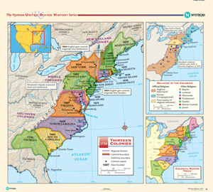
Nystrom History Wall Map Sets cover U.S. history in depth, starting in the 1400s. World history is covered from the New Babylonian Empire up to current world conflicts. These maps are designed to teach both advanced history and geographic literacy.
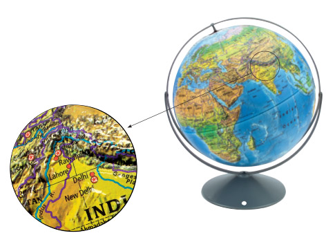
In high school, political, land cover, and sculptural raised-relief globes feature 3D shaded relief. Sophisticated details—such as city population ranges and major ecological regions—help build more advanced geographic literacy skills.
Please fill out the form and your curriculum specialist will be in touch shortly.
Elementary
| Secondary
|
U.S. History
| World History
|
Texas
|