
Redesigned for Today
Our new elementary atlases have been completely redesigned and updated to reflect the world we're living in, which will help your students better connect to it, both locally and globally.
Colorful maps and graphics, easy-to-follow nonfiction texts, and engaging hands-on activities meet the needs of every learner.
Ready to upgrade? Contact us.

Turnkey Activities
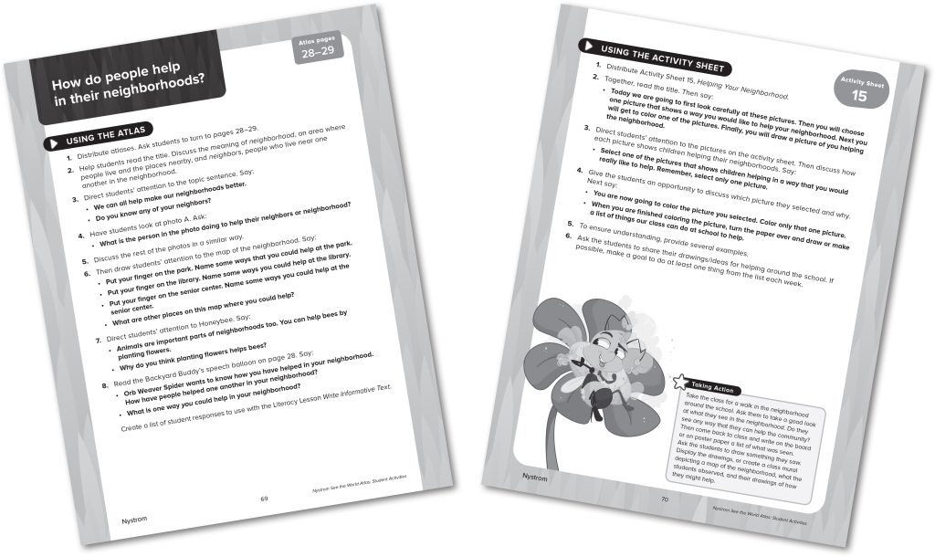
Easily integrate social studies into instructional time. There's a student activity for each two-page spread of the atlases, which can be completed in 15–30 minutes.
Choose the activities that will fit your needs and engage your students. Which activities you do and when is completely flexible.

Standards Strong
With our new atlases, it's easy to teach the right skills at the right time with the right amount of support. The atlases and activities are scaffolded and aligned to social studies standards and the C3 Framework.
Register for a free trial to see for yourself.

Digital Options
Atlas e-books and brand-new interactive activities for Grades 1–5 support learning anytime, anywhere.
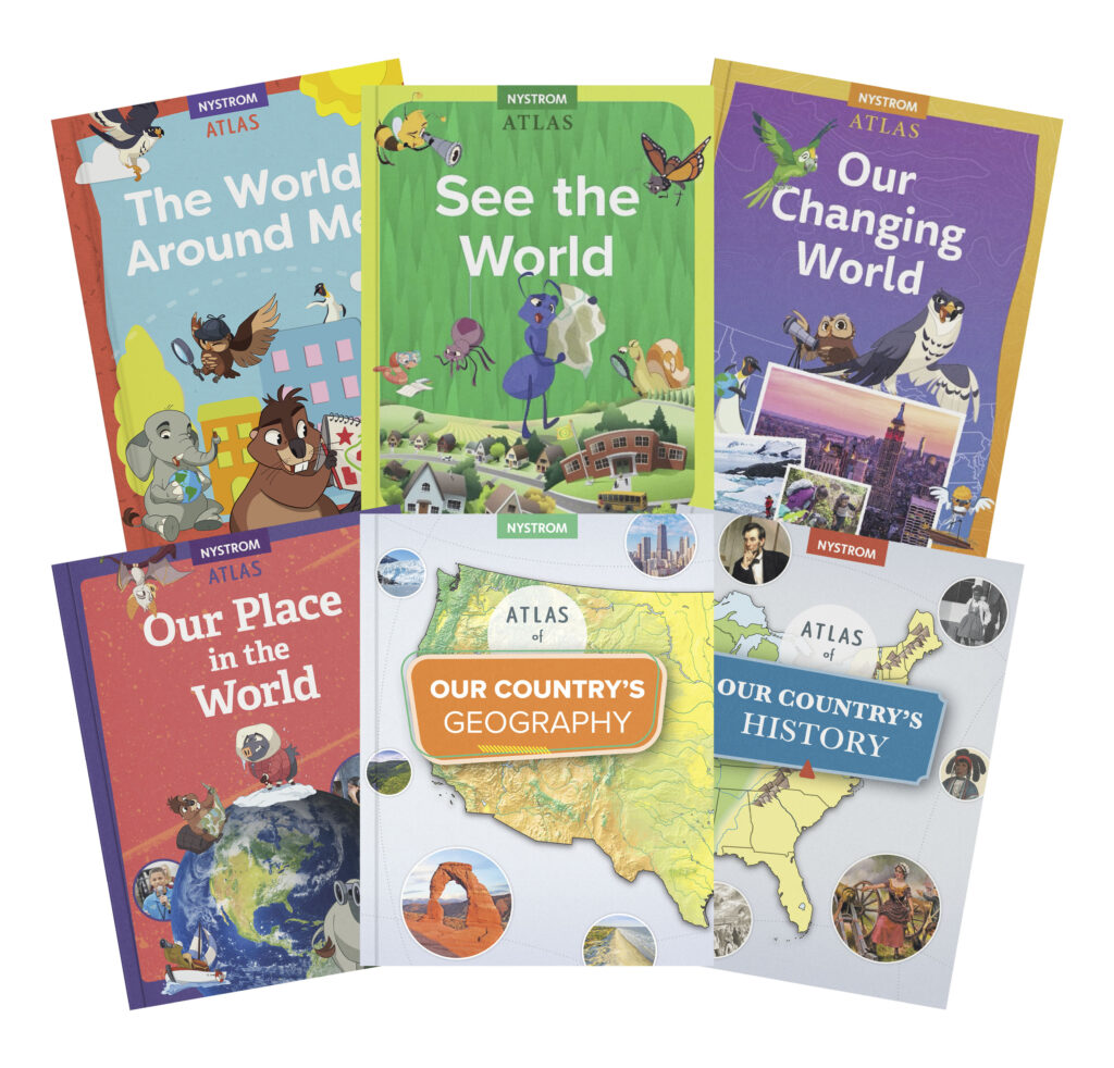

The World Around Me
Theme: Community
Focus: Family, Friends, and Home
The World Around Me helps kindergarteners discover how maps and globes work, recognize different types of homes and neighborhoods, explore where they live, and see how children around the world are both like them and different—all led by the friendly Planet Pals that make learning playful and relatable.
Spanish atlas pack also available.
Atlas Pack Components
- 30 The World Around Me atlases
- Reproducible student activity book
- 5-year subscription to Nystrom World Researcher:
- Atlas e-book
- Interactive activities

See the World
Theme: Perspective
Focus: Neighborhoods
See the World helps first graders understand what we can see on maps and globes, what neighborhoods look like, where people live and work, and how children on different continents are like them.
Backyard Buddies show first graders the world from different perspectives.
Spanish atlas pack also available.
Atlas Pack Components
- 30 See the World atlases
- Reproducible student activity book
- 5-year subscription to Nystrom World Researcher:
- Atlas e-book
- Interactive activities

Our Changing World
Theme: Change
Focus: Communities
Our Changing World helps second graders explore the people and places that make up a community, both locally and globally.
Bird Guides help second graders focus on change over time and from place to place as well as how maps change how we see the world.
Spanish atlas pack also available.
Atlas Pack Components
- 30 Our Changing World atlases
- Reproducible student activity book
- 5-year subscription to Nystrom World Researcher:
- Atlas e-book
- Interactive activities

Our Place in the World
Theme: Taking action
Focus: Countries and continents
Our Place in the World is designed to help third graders ask questions and take action as they learn about how communities work, our government, and what it's like to live on other continents.
Habitat Helpers ask compelling questions that lead to deeper knowledge and help strengthen students' map skills.
Spanish atlas pack also available.
Atlas Pack Components
- 30 Our Place in the World atlases
- Reproducible student activity book
- 5-year subscription to Nystrom World Researcher:
- Atlas e-book
- Interactive activities

Our Country's Geography
Focus: Regions of the U.S.
Our Country's Geography focuses on more advanced map skills and explores the regions of the United States, including environmental, geographic, and technological developments.
"Taking Action" pop-outs ask compelling questions to inspire fourth graders to engage with their environments.
Spanish atlas pack also available.
Atlas Pack Components
- 30 copies of Atlas of Our Country's Geography
- Reproducible student activity book
- 5-year subscription to Nystrom World Researcher:
- Atlas e-book
- Interactive activities

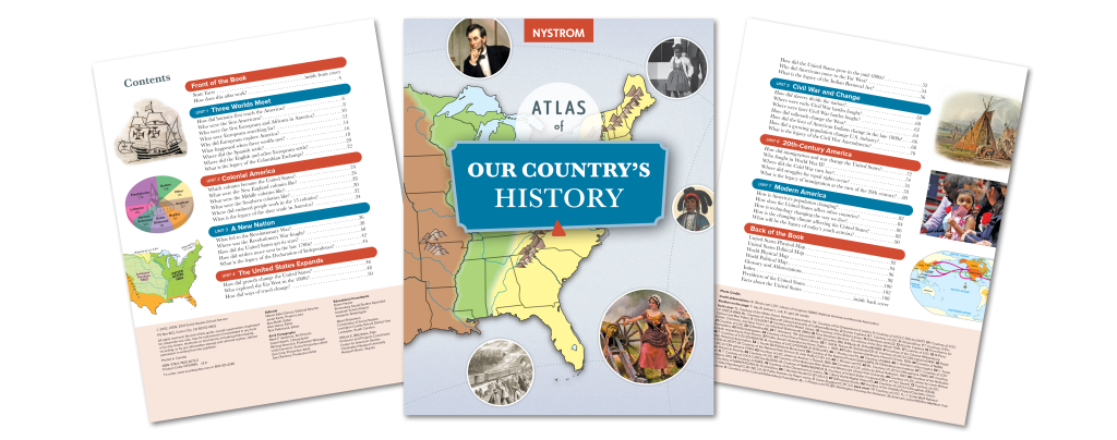
Our Country's History
Focus: U.S. history
Our Country's History takes fifth graders on an exploration of major events situated in time and place, from 1400 to the present.
"Lasting Legacies" focus on events from different time periods and their impact on the future.
Spanish atlas pack also available.
Atlas Pack Components
- 30 copies of Atlas of Our Country's History
- Reproducible student activity book
- 5-year subscription to Nystrom World Researcher:
- Atlas e-book
- Interactive activities
