Missouri History Resources

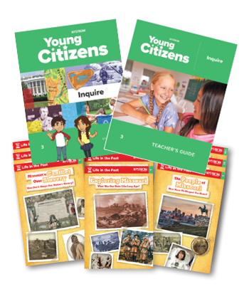
Our Missouri history resources for elementary students are designed to inspire deep interaction with content while aligning with standards in your state.

Young Citizens with Missouri History

Our social studies lessons help students learn and refine skills that will help them with ELA, math, and science, and better prepare them for high school and beyond.

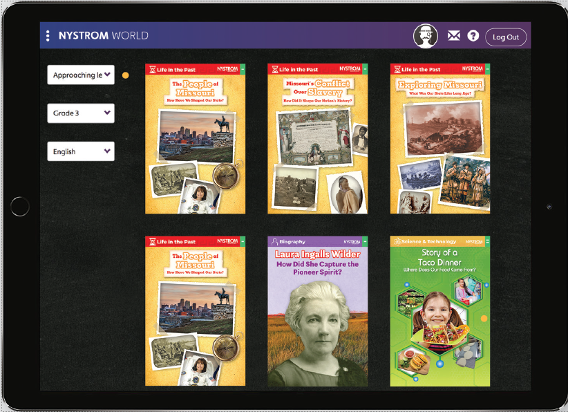
Leveled readers and activities enable teachers to differentiate learning experiences based on the abilities and learning styles of individual students.

Young Citizen's Group Activity Cards

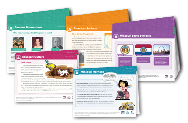
 Nystrom Young Citizens includes Group Activity Cards on different social studies topics
that directly correspond with the chapters of the Student Book. Each group activity card
includes images and information on the topic, making it easy to follow along. The cards
encourage collaborative learning while meeting key Missouri state standards.

Nystrom World's The Scholar

Missouri Specific LSR’s

Social Studies Readers are available for every reading level made specifically for Missouri students:

  • MISSOURI’S CONFLICT/SLAVERY-BEYOND
  • MISSOURI’S CONFLICT/SLAVERY-APPROACHING
  • MISSOURI’S CONFLICT/SLAVERY-ON
  • EXPLORING MISSOURI – BEYOND
  • EXPLORING MISSOURI – APPROACHING
  • EXPLORING MISSOURI – ON
  • PEOPLE OF MISSOURI – BEYOND
  • PEOPLE OF MISSOURI – APPROACHING
  • PEOPLE OF MISSOURI – ON

Nystrom World's The Geographer with Missouri State Map

Nystrom World’s The Geographer includes maps and reference tools you know compiled digitally to support your classroom. Combine with the print versions of wall or desk maps for an even more hands-on experience to expand student understanding.

Missouri State Map

Map (NYS317)

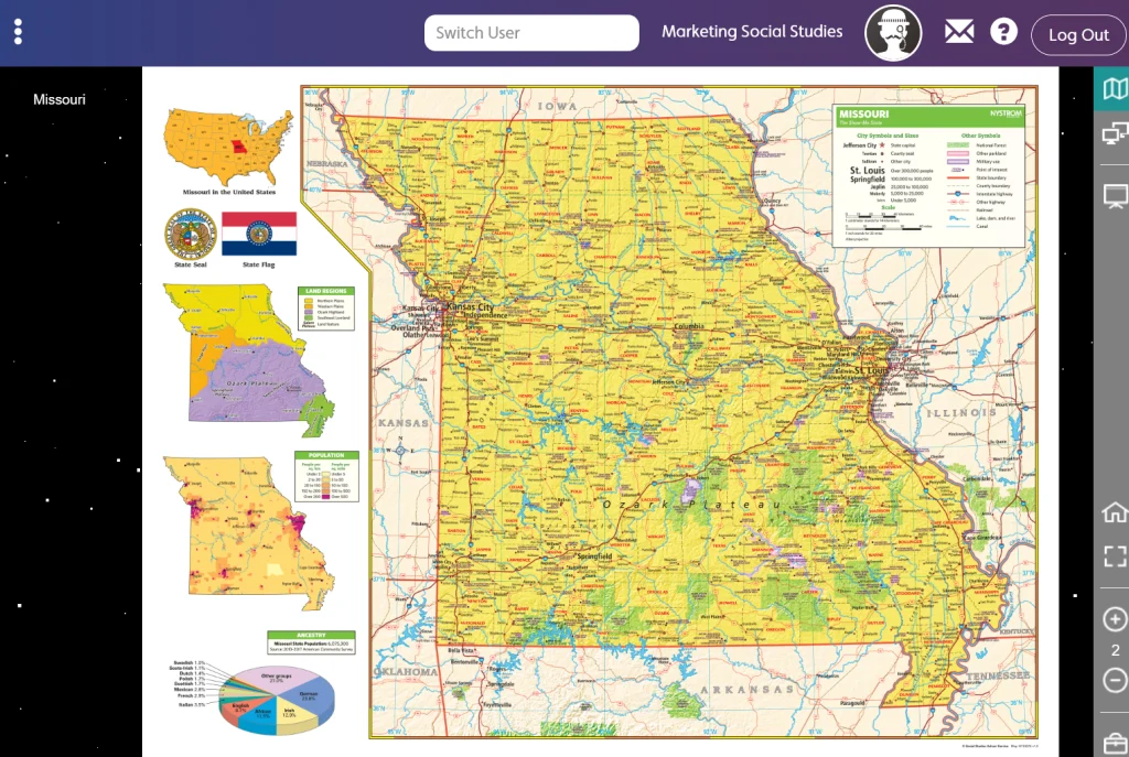
Laminated and mounted on a spring roller designed for hanging on a one-inch map rail (required), this Missouri state map shows counties, highways, cities and towns (with alphanumeric gazetteers in the margins), national and state forests and parks, bodies of water, and points of historical interest.

Missouri Desk Map

Desk Map (NYS3424D)

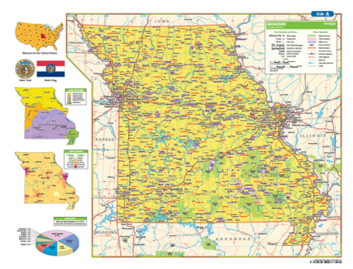
Packs of 30 double-sided, laminated, markable desk maps give students a detailed look at Missouri. There is a detailed political map on one side and either a physical or unlabeled map on the other. The maps include a variety of thematic insets showing population density, land use, annual precipitation and more. The desk maps are included with a 16-page teacher’s guide with reproducible handout.

Meet Your State Curriculum Specialist

Kimberly Fudge, curriculum specialist

Kimberly Fudge

Missouri curriculum specialist

(800) 421-4246 x295

Enhance the Classroom

Contact your curriculum specialist about bringing these exciting maps and globes into your school!

Elementary

  • Maps: Primary: ELS
  • Maps: Primary: Readiness
  • Maps: Primary: Outline World Map
  • Maps: Intermediate: Physical
  • Maps: Intermediate: Political
  • Maps: Intermediate: Continents and Oceans Thematic
  • Maps: Intermediate: Wealth of Countries Thematic
  • Maps: Intermediate: Precipitation Thematic
  • Maps: Intermediate: Temperature Thematic
  • Maps: Intermediate: Time Zones Thematic
  • Maps: Intermediate: Land Use Thematic
  • Maps: Intermediate: Population Thematic
  • Maps: Intermediate: Outline World Map
  • U.S. History:1 Native Americans
  • U.S. History:2 Spanish Explorers
  • U.S. History:3 Explorers
  • U.S. History:4 The Great Exchange
  • U.S. History:5 European Settlements
  • U.S. History:6 Thirteen Britishi Colonies
  • U.S. History:7 Slevery In the Americas
  • U.S. History:8 Revolutionary War
  • State Map

Secondary

  • Maps: Intermediate: Physical
  • Maps: Intermediate: Political
  • Maps: Intermediate: Continents and Oceans Thematic
  • Maps: Intermediate: Wealth of Countries Thematic
  • Maps: Intermediate: Precipitation Thematic
  • Maps: Intermediate: Temperature Thematic
  • Maps: Intermediate: Time Zones Thematic
  • Maps: Intermediate: Land Use Thematic
  • Maps: Intermediate: Population Thematic
  • Maps: Intermediate: Outline World Map
  • Maps: Secondary: Land Use Thematic
  • Maps: Secondary: Population Thematic
  • Maps: Secondary: Political Relief
  • Maps: Secondary: Land Cover
  • Maps: Secondary: Scupltural Relief
  • Maps: Secondary: Growing Seasons Thematic
  • Maps: Secondary: Climate Thematic
  • Maps: Secondary: Tectonic Plates Thematic
  • Maps: Secondary: Precipitation Thematic
  • Maps: Secondary: Outline World Map
  • State Map

U.S. History

  • Native Americans
  • Spanish Explorers
  • Explorers
  • The Great Exchange
  • European Settlements
  • Thirteen British Colonies
  • Slavery in the Americas
  • Revolutionary War
  • American Expansion
  • Explorations of the West
  • Trails West
  • War with Mexico
  • Slavery Divides the Nation
  • Slavery and the Economy
  • Union and Confederacy
  • Civil War
  • Conflicts with Indians
  • Railroads Tansform the West
  • Industrial United States
  • Immigrants 1895–1929
  • World War I in Europe
  • Great Depression and Dust Bowl
  • World War II in Europe 1939–1942
  • World War II in the Pacific 1941–1945
  • Great Migration 1940–1970
  • Korean War
  • Cold War
  • Vietnam War
  • Persian Gulf War
  • A Shifting Population
  • Immigrants Sinve 1970

World History

  • New Babylonian Empire
  • Ancient Egypt
  • Chinese Dynasties
  • Ancient India
  • Athens and Sparta
  • Alexander’s Empire
  • Roman Empire
  • Barbarians and the Roman Empire
  • Silk Road and Eurasian Trade
  • Byzantine Empire
  • Charlemagne’s Frankish Empire and the Holy Roman Empire
  • Spread of Islam
  • World of the Crusades
  • China in the Middle Ages
  • Mongol Conquest
  • Rise and Fall of Shogun Japan
  • Exploration
  • Maya, Aztec, and Inca
  • European Exploration and Land Claims
  • African Empires and States
  • Rise of Ottoman Empire
  • Reformation and Counter Reformation
  • European Trading Empires
  • Rise and Fall of Mughal Empires
  • Independence in the Americas
  • Napoleon’s Europe
  • Europe After the Congress of Vienna
  • Africa Under Foreign Rule
  • World War I
  • World War II
  • Cold War
  • World Conflicts Since 1991

Texas

  • Spanish Explorers
  • Western Explorations
  • Trails West
  • War with Mexico
  • Indian Wars
  • Railroads & The West
  • Great Migration
  • population Loss and Growth
  • Native Americans in TX
  • Spanish Settlements
  • Republic of Texas
  • Energy Resources of TX
  • Texas Readiness Map
  • Texas Desk Map
  • Texas State Map