Help your first-graders better understand the world around us by exploring the world around them, starting with neighborhoods.
Discover What's Inside
See the World helps first-graders understand what we can see on maps and globes, what neighborhoods look like, where people live and work, and how children on different continents are like them.
Backyard Buddies help first-graders explore their world from the insects’ own unique perspectives.
Build Foundational Skills
First-graders learn geographic literacy skills and primary social studies concepts such as
identifying symbols on a map;
interpreting and comparing photographs and maps;
identifying different types of homes;
identifying changes in a neighborhood;
locating their state on a map; and
describing differences in seasons.
Turnkey and Cross-Curricular
First-graders have fun applying their skills in engaging, hands-on ways, including creating make-believe telescopes and colorful mobiles.
Activities include discussion guides and cross-curricular connections, making it easy to incorporate social studies into instructional time.
Literacy lessons are designed to build ELA skills and concepts—such as categorizing words and describing connections—in the context of social studies.
Anytime, Anywhere
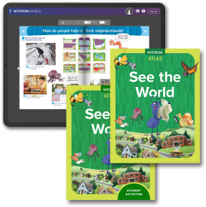
Meet students where they are and engage parents in their learning with digital resources, including an e-atlas and brand-new interactive activities.
“The Atlases are age appropriate and are bright and inviting for the students. The teachers like the resources that go with the atlases since they connect with literacy lessons and standards. I also like how the atlases build upon each other each year, you can really see the progression of geography skills.”
Suzanne Gons
District Supervisor of Social Studies
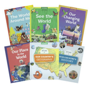
Essential Geography Resources
SPANISH VERSION
ATLAS PACK
K-5 BUNDLE
Register for a Free Trial
Please fill out the form and a curriculum specialist will be in touch shortly
Elementary
Maps: Primary: ELS
Maps: Primary: Readiness
Maps: Primary: Outline World Map
Maps: Intermediate: Physical
Maps: Intermediate: Political
Maps: Intermediate: Continents and Oceans Thematic
Maps: Intermediate: Wealth of Countries Thematic
Maps: Intermediate: Precipitation Thematic
Maps: Intermediate: Temperature Thematic
Maps: Intermediate: Time Zones Thematic
Maps: Intermediate: Land Use Thematic
Maps: Intermediate: Population Thematic
Maps: Intermediate: Outline World Map
U.S. History:1 Native Americans
U.S. History:2 Spanish Explorers
U.S. History:3 Explorers
U.S. History:4 The Great Exchange
U.S. History:5 European Settlements
U.S. History:6 Thirteen Britishi Colonies
U.S. History:7 Slevery In the Americas
U.S. History:8 Revolutionary War
State Map
Secondary
Maps: Intermediate: Physical
Maps: Intermediate: Political
Maps: Intermediate: Continents and Oceans Thematic
Maps: Intermediate: Wealth of Countries Thematic
Maps: Intermediate: Precipitation Thematic
Maps: Intermediate: Temperature Thematic
Maps: Intermediate: Time Zones Thematic
Maps: Intermediate: Land Use Thematic
Maps: Intermediate: Population Thematic
Maps: Intermediate: Outline World Map
Maps: Secondary: Land Use Thematic
Maps: Secondary: Population Thematic
Maps: Secondary: Political Relief
Maps: Secondary: Land Cover
Maps: Secondary: Scupltural Relief
Maps: Secondary: Growing Seasons Thematic
Maps: Secondary: Climate Thematic
Maps: Secondary: Tectonic Plates Thematic
Maps: Secondary: Precipitation Thematic
Maps: Secondary: Outline World Map
State Map
U.S. History
Native Americans
Spanish Explorers
Explorers
The Great Exchange
European Settlements
Thirteen British Colonies
Slavery in the Americas
Revolutionary War
American Expansion
Explorations of the West
Trails West
War with Mexico
Slavery Divides the Nation
Slavery and the Economy
Union and Confederacy
Civil War
Conflicts with Indians
Railroads Tansform the West
Industrial United States
Immigrants 1895–1929
World War I in Europe
Great Depression and Dust Bowl
World War II in Europe 1939–1942
World War II in the Pacific 1941–1945
Great Migration 1940–1970
Korean War
Cold War
Vietnam War
Persian Gulf War
A Shifting Population
Immigrants Sinve 1970
World History
New Babylonian Empire
Ancient Egypt
Chinese Dynasties
Ancient India
Athens and Sparta
Alexander’s Empire
Roman Empire
Barbarians and the Roman Empire
Silk Road and Eurasian Trade
Byzantine Empire
Charlemagne’s Frankish Empire and the Holy Roman Empire