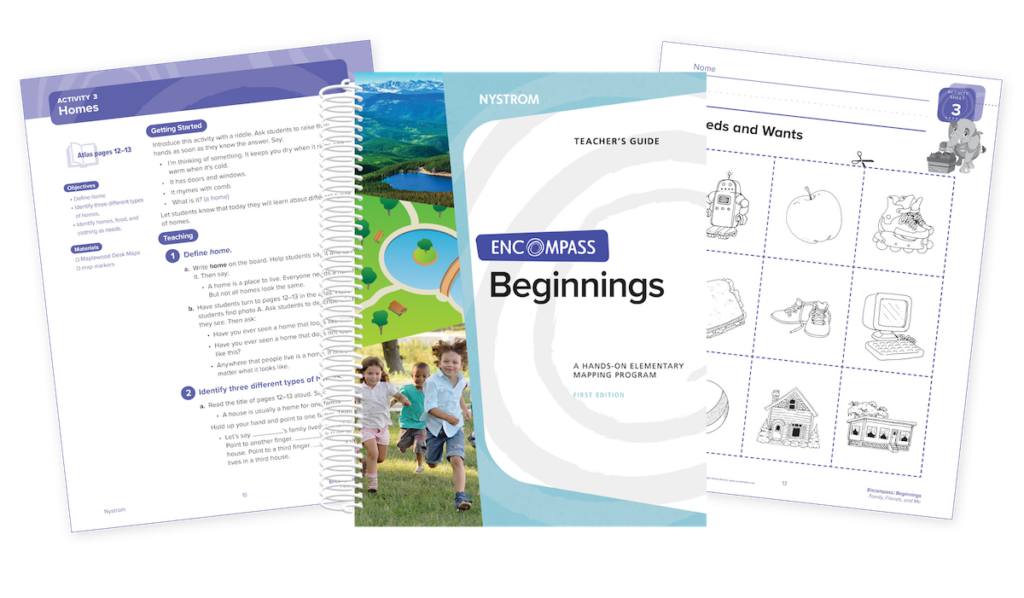
Introduce kindergartners to geography using developmentally appropriate tools and activities!
Discover What's Inside
Encompass Beginnings introduces kindergartners to geography through the following topics:
Unit 1: Family, Friends, and Me
Unit 2: Seeing Our World
Unit 3: Living Together
Unit 4: Our Country
Unit 5: Around the World
Build Foundational Skills
Using hands-on activities, you’ll teach kindergartners the following foundational skills and concepts:
Identifying items in an atlas
Identifying three different types of homes
Distinguishing between a map and a model
Drawing symbols on a map
Locating your state on a map
Comparing families from different parts of the world
Supplement Social Studies with Turnkey Activities
Encompass is a fun and flexible way to teach geographic literacy. Skills-based activities can be taught sequentially or stand on their own. And at 15–30 minutes, they’re easy to fit into instructional time.
Each activity includes an assessment and a cross-curricular extension. And we provide answer keys too! Activity Examples: Models and Maps, Town and Farm Alphabet, Symbols of Our Country, Global Celebrations
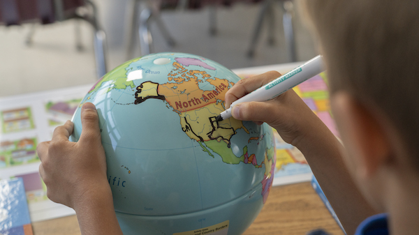
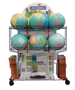
Get a Cartful of Components
Your students will enjoy working collectively with the markable globe, map, and Place Mat.
Encompass Beginnings Teacher’s Guide
The World Around Me Student Atlas—set of 30
9″ Activity Globe—set of 6
Community Desk Map—set of 30
Social Studies Place Mat—set of 6
Wet-Erase Markers—set of 30
Elementary Atlas Cart
Interactive Mapping Activities
Give Young Learners Digital Practice
Access the digital version of Beginnings at Nystrom World. Interactive mapping activities correspond to the print versions and give kindergartners practice with multistep problems. A PDF of the teacher’s guide is included.
Get a Free Sample
Please fill out the form and a curriculum specialist will be in touch shortly
Elementary
Maps: Primary: ELS
Maps: Primary: Readiness
Maps: Primary: Outline World Map
Maps: Intermediate: Physical
Maps: Intermediate: Political
Maps: Intermediate: Continents and Oceans Thematic
Maps: Intermediate: Wealth of Countries Thematic
Maps: Intermediate: Precipitation Thematic
Maps: Intermediate: Temperature Thematic
Maps: Intermediate: Time Zones Thematic
Maps: Intermediate: Land Use Thematic
Maps: Intermediate: Population Thematic
Maps: Intermediate: Outline World Map
U.S. History:1 Native Americans
U.S. History:2 Spanish Explorers
U.S. History:3 Explorers
U.S. History:4 The Great Exchange
U.S. History:5 European Settlements
U.S. History:6 Thirteen Britishi Colonies
U.S. History:7 Slevery In the Americas
U.S. History:8 Revolutionary War
State Map
Secondary
Maps: Intermediate: Physical
Maps: Intermediate: Political
Maps: Intermediate: Continents and Oceans Thematic
Maps: Intermediate: Wealth of Countries Thematic
Maps: Intermediate: Precipitation Thematic
Maps: Intermediate: Temperature Thematic
Maps: Intermediate: Time Zones Thematic
Maps: Intermediate: Land Use Thematic
Maps: Intermediate: Population Thematic
Maps: Intermediate: Outline World Map
Maps: Secondary: Land Use Thematic
Maps: Secondary: Population Thematic
Maps: Secondary: Political Relief
Maps: Secondary: Land Cover
Maps: Secondary: Scupltural Relief
Maps: Secondary: Growing Seasons Thematic
Maps: Secondary: Climate Thematic
Maps: Secondary: Tectonic Plates Thematic
Maps: Secondary: Precipitation Thematic
Maps: Secondary: Outline World Map
State Map
U.S. History
Native Americans
Spanish Explorers
Explorers
The Great Exchange
European Settlements
Thirteen British Colonies
Slavery in the Americas
Revolutionary War
American Expansion
Explorations of the West
Trails West
War with Mexico
Slavery Divides the Nation
Slavery and the Economy
Union and Confederacy
Civil War
Conflicts with Indians
Railroads Tansform the West
Industrial United States
Immigrants 1895–1929
World War I in Europe
Great Depression and Dust Bowl
World War II in Europe 1939–1942
World War II in the Pacific 1941–1945
Great Migration 1940–1970
Korean War
Cold War
Vietnam War
Persian Gulf War
A Shifting Population
Immigrants Sinve 1970
World History
New Babylonian Empire
Ancient Egypt
Chinese Dynasties
Ancient India
Athens and Sparta
Alexander’s Empire
Roman Empire
Barbarians and the Roman Empire
Silk Road and Eurasian Trade
Byzantine Empire
Charlemagne’s Frankish Empire and the Holy Roman Empire